Home › Campaign routes › The Battle of Lat Ya: the Burmese main force through Three Pagodas Pass › Sam Sop
Sam Sop, Sangkhla Buri: a Burmese camp in two wars, and the sunken town beneath the reservoir
Sam Sop, or Sam Prasop, is where three streams join to form the Khwae Noi River, at today's district town of Sangkhla Buri. In the Nine Armies' War it was the camp of the 7th army, under a son of King Bodawpaya. In the Tha Din Daeng campaign the following year it was a Burmese camp that the Siamese attacked together with the one at Tha Din Daeng.
The Battle of Lat Ya: the Burmese main force through Three Pagodas Pass
The 7th army of Prince Sagu, a son of King Bodawpaya, 11,000 men, camped at Sam Sop as the second line of support, passing supplies on from the royal army to the armies in front.
The Tha Din Daeng campaign: Siam strikes at the frontier
The camp at Sam Sop lay upstream of Tha Din Daeng. It was the camp the Front Palace prince's vanguard was assigned to attack.
- Against
- Another part of the Burmese vanguard
- Where
- The camp at Sam Sop, where the three streams meet
- How
- The Front Palace prince's vanguard under Phraya Kalahom Ratchasena, Phraya Cha Saenyakon and Chaophraya Rattanaphiphit built camps around it, then attacked at the same time as the assault on Tha Din Daeng.
- Outcome
- The camp fell at the same time. The Siamese pursued towards the pass.
Two wars at Sam Sop
From late 1785 to early 1786 the 7th army of Prince Sagu, 11,000 men, was camped here as the royal army's second line of support. When the vanguard was broken at Lat Ya in February 1786, the army at Tha Din Daeng passed the news to Sam Sop, and King Bodawpaya then ordered them all back to Martaban.
A year later the Burmese were back, camped at Sam Sop and Tha Din Daeng again, with granaries at intervals. This time the Siamese did not wait for the enemy to come down to the plain but marched up to attack the camps. After three days of fighting both Burmese camps fell.
The place today
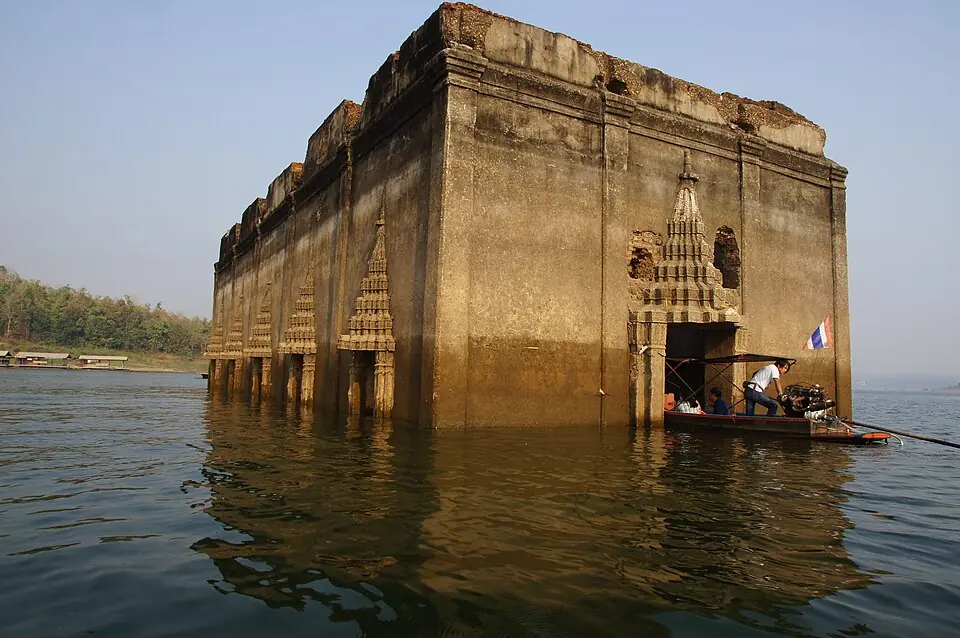
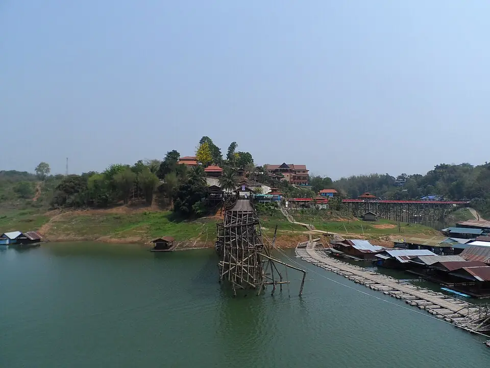
The old town of Sangkhla Buri and the former Wat Wang Wiwekaram have lain beneath the reservoir of Vajiralongkorn Dam since about 1984. When the water is low the old ordination hall rises above the surface; people call it Mueang Badan, the sunken town. You can take a boat to it from the landing near the Mon Bridge. The Mon Bridge is a long wooden bridge across the Songkalia River, and a popular place to give alms to monks in the morning.
Position on the map: The coordinates are for the Sam Prasop area, where the Songkalia, Bikhli and Ranti rivers meet. The old camp site lies beneath the surface of the reservoir.
Places to visit and eat near Sam Sop
Places to visit nearby
- The Mon Bridge (Uttamanusorn Bridge) ↗Google Maps
- Mueang Badan, the former Wat Wang Wiwekaram ↗Google MapsBy boat, when the water is low
- Wat Wang Wiwekaram and the Bodh Gaya-style chedi ↗Google Maps
- Kanchanaburi travel guidesongkran.com
Where to eat nearby
- The morning market on the Mon side ↗Google MapsMon home-style food
- Restaurants around this stop ↗Google Maps
Last updated 14 November 2026