Home › Campaign routes › The Tha Din Daeng campaign: Siam strikes at the frontier
The Tha Din Daeng campaign: Siam strikes at the frontier
A year after the Nine Armies' War, King Bodawpaya sent the crown prince with 50,000 men to try again. This time they came by a single route and set up granaries all along it to cure the old weakness. Siam changed its method too. Instead of waiting at Lat Ya, it marched more than 60,000 men up to attack the Burmese camps at Tha Din Daeng and Sam Sop, close to the frontier.
- Enemy army
- Siamese army
- 1Stops, numbered as in the list below
- 2Clash with the Burmese
- 2Main battlefield
- 1–3Several stops close together: tap to zoom in
- ≈ approximate position
Press + to zoom in, then drag to move the map; on a phone you can pinch. Tap a number to read about that stop.
The mark ≈ means an approximate position. Borders on the map are present-day borders, shown only to help you find places. The routes are approximate lines drawn from the chronicles and later studies, not the actual path step by step. Dashed lines are enemy armies; solid lines are Siamese armies.
Burma fixes its supplies, Siam fixes the distance
The Burmese had learned from the previous war that hunger had beaten them. So they brought in food from Arakan and Lower Burma to stockpile, and set up depots at intervals from Martaban to their forward camps. But having depots meant the army had to stay where it was to guard them.
Siam judged that if the Burmese were allowed to dig in, they would push south again, so it chose to attack first. King Rama I led the royal army in person, with the Front Palace prince commanding the vanguard. They went by boat up the Khwae Noi River to Sai Yok, then marched overland until they were close up against the Burmese camps.
Three days at Tha Din Daeng
The Siamese attacked the camps at Tha Din Daeng and Sam Sop at the same time, so that neither could help the other. After three days of fighting, day and night, all the Burmese camps had fallen. The Siamese pursued, burning the supply depots along the road, as far as the crown prince's camp beyond the pass.
After this campaign the situation was reversed. In the following years it was Siam that went on the attack against Tavoy, while Burma turned to pressing Lanna instead. Three Pagodas Pass, for centuries the way in for Burmese armies, fell quiet.
The route in 6 stops
Dates on this page are in the Common Era. Old Thai documents count February 1787 (BE 2330) as still falling in BE 2329, which is why many Thai books date the Tha Din Daeng campaign to BE 2329 (1786). The dates of the fighting follow the conversion given by Thai Wikipedia.
- 1
Bangkok (Phra Nakhon)
King Rama I and Prince Maha Sura Singhanat left Bangkok with their armies by boat: the Front Palace prince's vanguard of about 30,000, and the royal army of more than 30,000. This time they did not wait to defend at Lat Ya but went up to attack the enemy at the frontier.
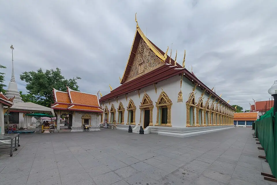
Wat Chana Songkhram, in the Bang Lamphu area of Bangkok · Photo: Supanut Arunoprayote · CC BY 4.0 via Wikimedia Commons Bangkok was only three years old when the Nine Armies' War broke out. The places most directly tied to the war are Wat Chana Songkhram in the Bang Lamphu area, which Prince Maha Sura Singhanat restored and which received its name, “temple of victory in war”, after his victories over the Burmese, and the grounds of the former Front Palace, today the Bangkok National Museum.
Places to visit nearby
- Wat Chana Songkhram ↗Google Maps
- Bangkok National Museum (the former Front Palace) ↗Google Maps
- Monument to Prince Maha Sura Singhanat, Wat Mahathat Yuwaratrangsarit ↗Google Maps
- Bangkok travel guidesongkran.com
Where to eat nearby
- Bang Lamphu and Phra Athit Road ↗Google Maps
- Restaurants around this stop ↗Google Maps
- 2
Sai Yok
The fleet went up the Khwae Noi River to Sai Yok, where the army landed and marched on. The Front Palace prince sent a vanguard of 20,000 ahead in haste to close with the Burmese camp at Sam Sop.
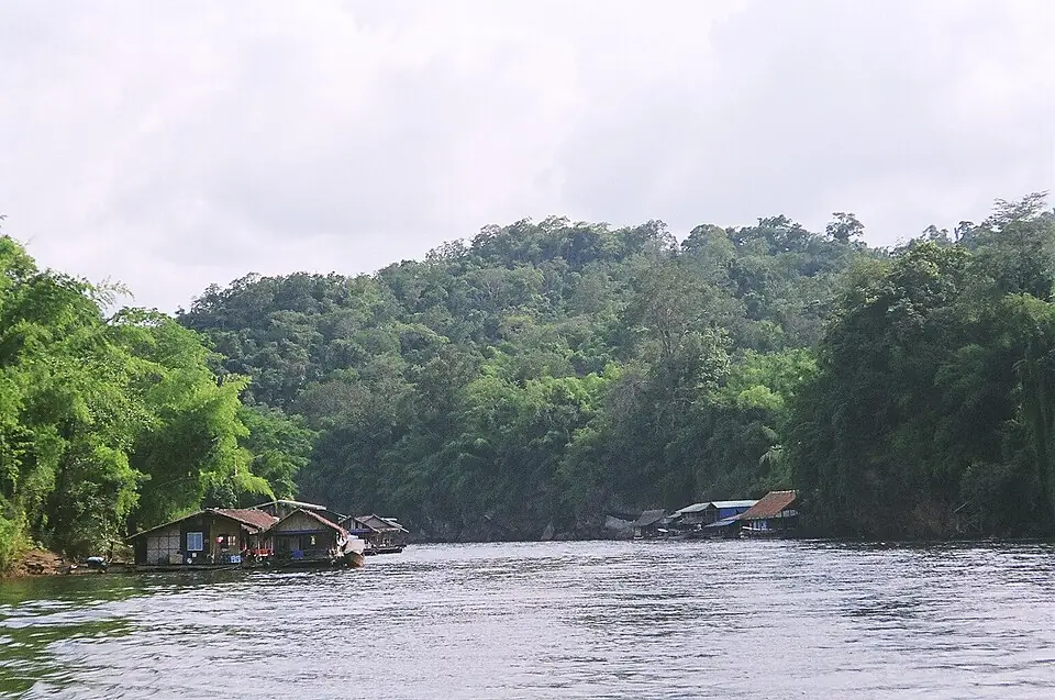
The Khwae Noi River in Sai Yok National Park · Photo: Ananda · Public domain via Wikimedia Commons Sai Yok was a frontier post of Kanchanaburi on the Khwae Noi River. Today it is Sai Yok National Park, where Sai Yok Yai Waterfall drops into the Khwae Noi, with raft houses to stay in and boat trips on the river. Sai Yok Noi Waterfall is beside Highway 323, near the district town.
Position on the map: The coordinates are for the headquarters of Sai Yok National Park on the Khwae Noi River. The old town of Sai Yok was in the same area.
Places to visit nearby
- Sai Yok Yai Waterfall, Sai Yok National Park ↗Google Maps
- Sai Yok Noi Waterfall ↗Google Maps
- Hellfire Pass Interpretive Centre ↗Google MapsThe Second World War “Death Railway”, which followed the Khwae Noi along the same line as the old military road
- Kanchanaburi travel guidesongkran.com
Where to eat nearby
- Restaurants around this stop ↗Google Maps
- 3
Tha Khanun (Thong Pha Phum)
The royal army camped at Tha Khanun as a base in support of the vanguard that had gone ahead, before moving up after it to camp near the Burmese camp at Tha Din Daeng.
Tha Khanun is the site of today's district town of Thong Pha Phum, on the Khwae Noi River, with Vajiralongkorn Dam upstream. The town has a morning market and Wat Tha Khanun.
Places to visit nearby
- Vajiralongkorn Dam ↗Google Maps
- Wat Tha Khanun ↗Google Maps
- Kanchanaburi travel guidesongkran.com
Where to eat nearby
- Thong Pha Phum market ↗Google Maps
- Restaurants around this stop ↗Google Maps
- 4
Tha Din Daeng
The Burmese vanguard was camped at Tha Din Daeng and Sam Sop, with the granaries of supplies it had brought up and stored. The Siamese came up and built their camps only two or three kilometres away.
Main battlefield of this campaign- Against
- The Burmese vanguard of about 30,000 under Myin Wun and Myinme Wun, the same commanders who had lost at Lat Ya
- Where
- The camp at Tha Din Daeng, on the upper Khwae Noi River
- How
- The Siamese attacked the camps at Tha Din Daeng and Sam Sop at the same time, with cannon fire exchanged day and night.
- Outcome
- After three days of fighting all the Burmese camps had fallen.
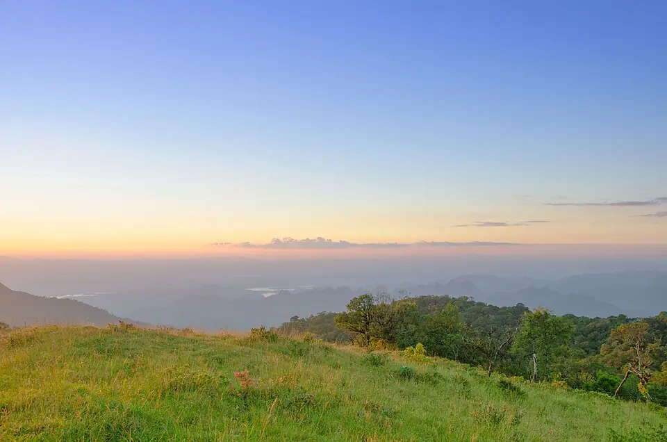
The mountains above the Vajiralongkorn Dam reservoir, in Khao Laem National Park · Photo: Kzoverheat · CC BY-SA 3.0 via Wikimedia Commons Today Ban Tha Din Daeng is a community on the shore of the Vajiralongkorn Dam reservoir, in Prang Phle subdistrict. There is no memorial of the fighting in the area. Highway 323 between Thong Pha Phum and Sangkhla Buri passes close by, with reservoir viewpoints and Khao Laem National Park along the way.
Position on the map: Approximate coordinates of the Ban Tha Din Daeng area, Prang Phle subdistrict, Sangkhla Buri district. The old camp site on the Khwae Noi River lies beneath the reservoir of Vajiralongkorn Dam.
Places to visit nearby
- Vajiralongkorn Dam (Khao Laem Dam) ↗Google Maps
- Khao Laem National Park ↗Google Maps
- Kanchanaburi travel guidesongkran.com
Where to eat nearby
- Restaurants around this stop ↗Google Maps
- 5
Sam Sop (Sam Prasop, Sangkhla Buri)
The camp at Sam Sop lay upstream of Tha Din Daeng. It was the camp the Front Palace prince's vanguard was assigned to attack.
Clash with the Burmese army- Against
- Another part of the Burmese vanguard
- Where
- The camp at Sam Sop, where the three streams meet
- How
- The Front Palace prince's vanguard under Phraya Kalahom Ratchasena, Phraya Cha Saenyakon and Chaophraya Rattanaphiphit built camps around it, then attacked at the same time as the assault on Tha Din Daeng.
- Outcome
- The camp fell at the same time. The Siamese pursued towards the pass.
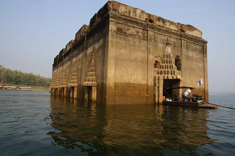
The ordination hall of the old Wat Wang Wiwekaram, known as the sunken temple, at Sam Prasop, Sangkhla Buri · Photo: Z3144228 · CC BY-SA 4.0 via Wikimedia Commons The old town of Sangkhla Buri and the former Wat Wang Wiwekaram have lain beneath the reservoir of Vajiralongkorn Dam since about 1984. When the water is low the old ordination hall rises above the surface; people call it Mueang Badan, the sunken town. You can take a boat to it from the landing near the Mon Bridge. The Mon Bridge is a long wooden bridge across the Songkalia River, and a popular place to give alms to monks in the morning.
Position on the map: The coordinates are for the Sam Prasop area, where the Songkalia, Bikhli and Ranti rivers meet. The old camp site lies beneath the surface of the reservoir.
Places to visit nearby
- The Mon Bridge (Uttamanusorn Bridge) ↗Google Maps
- Mueang Badan, the former Wat Wang Wiwekaram ↗Google MapsBy boat, when the water is low
- Wat Wang Wiwekaram and the Bodh Gaya-style chedi ↗Google Maps
- Kanchanaburi travel guidesongkran.com
Where to eat nearby
- The morning market on the Mon side ↗Google MapsMon home-style food
- Restaurants around this stop ↗Google Maps
- 6
Three Pagodas Pass
The Siamese chased the fleeing Burmese as far as the crown prince's camp on the Mae Kasat stream, beyond the pass. The crown prince withdrew to Martaban. The Siamese burned all the granaries and supplies the Burmese had stored along the road, then ended the campaign and went home.
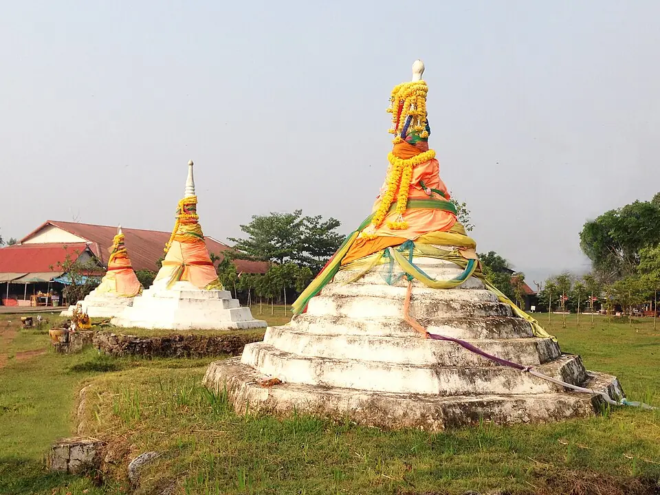
The three pagodas at Three Pagodas Pass, Sangkhla Buri district · Photo: Woonzen5558 · CC BY-SA 4.0 via Wikimedia Commons Today it is a border trade checkpoint between Thailand and Myanmar. Three small white chedis stand in a row on a lawn, surrounded by souvenir shops, about 20 kilometres from the district town of Sangkhla Buri. The crossing opens and closes as the situation changes, so check before you travel.
Places to visit nearby
- The three pagodas and the border market ↗Google Maps
- The Mon Bridge, Sangkhla Buri ↗Google MapsAbout 20 km from the pass
- Kanchanaburi travel guidesongkran.com
Where to eat nearby
- Restaurants around this stop ↗Google Maps
Travel guides for the provinces on this route
Things to do and where to eat in each province, from songkran.com, our sister travel site
- BangkokStop 1Bangkok travel guide →
- KanchanaburiStop 2, 3, 4, 5, 6Kanchanaburi travel guide →
Where historians still disagree
- The year of the war: most Thai books write BE 2329 (1786), following the old calendar. The fighting actually took place in February 1787, which is BE 2330 by the modern count.
- Numbers: the 50,000 Burmese is the total assembled at Martaban. The vanguard that actually came forward and built camps numbered about 30,000. Some sources give 36,000 for the Burmese force that came in.
- The sites of the camps: both Tha Din Daeng and Sam Sop now lie beneath the reservoir of Vajiralongkorn Dam. The pins on the map are approximate.
Frequently asked questions
Where is Tha Din Daeng?
On the upper Khwae Noi River, in Prang Phle subdistrict, Sangkhla Buri district, Kanchanaburi. Today the site of the old camps lies beneath the reservoir of Vajiralongkorn Dam.
How was the Tha Din Daeng campaign different from the Nine Armies' War?
It was fought the following year. Burma came by one route instead of five, and Siam marched up to attack the Burmese camps instead of defending at Lat Ya.
What is Nirat Tha Din Daeng?
A long poem, believed to have been written by King Rama I himself, about his march to fight the Burmese at Tha Din Daeng on this occasion.
Last updated 14 November 2026