Home › Campaign routes › The Battle of Lat Ya: the Burmese main force through Three Pagodas Pass › Lat Ya
Lat Ya: the main battlefield of the Nine Armies' War, and the Nine Armies' War Historical Park
Lat Ya, at the foot of the Khao Banthat hills above the old town of Kanchanaburi, is where Prince Maha Sura Singhanat took 30,000 men to face the Burmese vanguard right at the point where the road leaves the forested hills. The two sides were locked in fighting for about two months, until the Burmese camps were stormed on 17 February 1786, and King Bodawpaya's royal army had to withdraw altogether.
What happened here
Prince Maha Sura Singhanat left Bangkok with 30,000 men in December 1785 and built his camps across the mouth of the valley before the Burmese came down. In January King Rama I followed with the royal army of 20,000 to help, but when the Front Palace prince reported that the Burmese were starving and close to breaking, the king went back to guard the capital.
- Against
- Burma's 4th and 5th armies, about 15,000–16,000 men in all, with three more armies in support strung out behind them as far as the frontier
- Where
- Lat Ya, at the foot of the Khao Banthat hills above the old town of Kanchanaburi; today in Chong Sadao and Lat Ya subdistricts, Mueang Kanchanaburi district
- How
- They built camps across the mouth of the valley, exchanged cannon fire from battle towers, sent guerrillas to cut the supply line, tricked the enemy into thinking reinforcements arrived every day, then attacked every camp at once when the enemy was starving.
- Outcome
- The Burmese camps fell on the evening of 17 February 1786. The Siamese pursued as far as the frontier, and King Bodawpaya ordered every army back to Martaban.
Why make the stand at Lat Ya?
The military road from Three Pagodas Pass down the Khwae Noi and Khwae Yai is a narrow road through the valleys, and it opens onto the plain at Lat Ya. If the Burmese army of 89,000 had been allowed out onto the plain, the smaller Siamese army could not have held it. So the Front Palace prince chose to build his camps across the mouth of the valley, forcing the enemy to stay strung out in forested hills where no food could be found.
The only Burmese to reach Lat Ya were the vanguard, the 4th and 5th armies, about 15,000–16,000 men in all. The two sides built lines of linked stockades facing each other and raised battle towers to carry cannon for an exchange of fire. The chronicle says the Front Palace prince had three large mortars made and declared that anyone who fled from the enemy would be put in a mortar and pounded.
Guerrillas, cut supplies and a ruse
He sent 500 guerrillas to ambush the Burmese supply columns at Phu Takhrai, but the three officers in charge hung back and did not go into action, and were executed. He then put Prince Khun Nen in command of about 1,500–1,800 men to do the job instead. This force seized food, elephants and horses along the supply road until the Burmese could no longer get supplies to their vanguard. The location of Phu Takhrai is not known for certain, only that it was on the supply road between Sai Yok and Lat Ya.
Another ruse was to have soldiers slip out of camp at night and march back in as a column by day, so that the Burmese would think reinforcements were arriving every day. When the Burmese were starving and disease had broken out in their camps, he ordered an attack on every camp at once on 17 February 1786. The fighting lasted from morning until dusk, and the Burmese camps fell. The Burmese chronicle records the loss of about 6,000 men at Lat Ya.
How to get there
From Kanchanaburi town take Highway 323 towards Kaeng Sian, then turn onto Highway 3199 towards Srinagarind Dam. You pass Lat Ya subdistrict, which has the ruins of old Kanchanaburi town. Drive on to around kilometre 24, where a turning on the left leads to the park. Allow about an hour for the visit, then carry on to Erawan Falls on the same road.
The place today
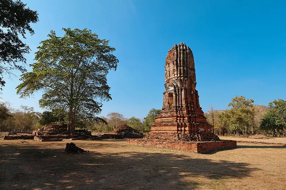
The Royal Thai Army built the Nine Armies' War Historical Park in Chong Sadao subdistrict, Mueang Kanchanaburi district. It is about 700 metres off Highway 3199 (Kanchanaburi–Srinagarind Dam), turning at around kilometre 24, roughly 40 kilometres from the town. Inside are an exhibition building, a sand-table model of the terrain and the two sides' positions, and an observation tower looking over the plain and the hills around it. Travel websites say it is open daily, 9:00 am–4:00 pm, with no entrance fee; check before you go.
Places to visit and eat near Lat Ya
Places to visit nearby
- Nine Armies' War Historical Park ↗Google MapsExhibition, sand-table model and observation tower
- Old Kanchanaburi town (Wat Khun Phaen, Wat Pa Lelai) ↗Google MapsThe site of Kanchanaburi at the time of the Nine Armies' War, before the town moved to Pak Phraek
- Erawan Falls ↗Google MapsAbout 40 km further along Highway 3199
- Kanchanaburi travel guidesongkran.com
Where to eat nearby
- Pak Phraek Walking Street (Saturday evenings) ↗Google MapsKanchanaburi's old town quarter
- Restaurants around this stop ↗Google Maps
- Nine Armies' War – Thai Wikipedia, citing the Royal Chronicle of Rattanakosin, First Reign, and Thai Rop Phama (in Thai)
- Burmese–Siamese War (1785–1786) – Wikipedia
- The Nine Armies' War Historical Park – lovethailand.org (in Thai)
- Prince Khun Nen, commander of the guerrilla force – Silpa Wattanatham (in Thai)
Last updated 14 November 2026