Home › Campaign routes › The Battle of Lat Ya: the Burmese main force through Three Pagodas Pass
The Battle of Lat Ya: the Burmese main force through Three Pagodas Pass
Of King Bodawpaya's nine armies, no fewer than five, 89,000 men in all, came in by the same route, Three Pagodas Pass, heading straight for Bangkok. Siam had far fewer men, so Prince Maha Sura Singhanat, the Front Palace prince, led 30,000 troops to block the mouth of the valley at Lat Ya, above the town of Kanchanaburi, and keep the enemy from reaching the plain. This battle decided the outcome of the whole war.
- Enemy army
- Siamese army
- 1Stops, numbered as in the list below
- 2Clash with the Burmese
- 2Main battlefield
- 1–3Several stops close together: tap to zoom in
- ≈ approximate position
Press + to zoom in, then drag to move the map; on a phone you can pinch. Tap a number to read about that stop.
The mark ≈ means an approximate position. Borders on the map are present-day borders, shown only to help you find places. The routes are approximate lines drawn from the chronicles and later studies, not the actual path step by step. Dashed lines are enemy armies; solid lines are Siamese armies.
The biggest army was the slowest
The five armies marched one behind another in stages. The 4th and 5th formed the vanguard. Behind them came the armies of two of the king's sons, at Tha Din Daeng and Sam Sop, and last of all King Bodawpaya's royal army of 50,000 at the frontier. The route ran through forested hills along the Khwae Noi River, with hardly a town where food could be found. Every sack of rice had to be carried from Martaban.
The bigger the army, the more it ate, and the deeper it advanced, the longer its supply line grew. This weakness showed even before the fighting began, when King Bodawpaya had the first commander of the 1st army executed for failing to gather enough supplies for the royal army.
Defending at the mouth of the valley, not at the city walls
In earlier wars with Burma the Siamese had usually defended from inside the capital and let the enemy lay siege. This time they changed their method: they marched out to meet the enemy at the frontier and chose the spot where he was at the greatest disadvantage. Lat Ya is where the valley road opens onto the plain. The Siamese built their camps across it, so the Burmese armies coming up behind had to halt in the forest, unable to come forward to help the vanguard and with no food to be found.
At Lat Ya the two sides faced each other from their camps for about two months, exchanging cannon fire from battle towers. The Siamese had wooden-shot guns, which fired logs as projectiles to smash the Burmese stockades and towers. All the while Prince Khun Nen's guerrillas kept attacking the supply columns in the rear. The Burmese chronicle records that the soldiers went so hungry they dug up taro and yams and ate their pack animals, and that disease then broke out in the camps.
The one day that decided the war
On the morning of Friday 17 February 1786 the Front Palace prince ordered every unit to attack the Burmese camps at once. The fighting went on until dusk, and the Burmese camps fell. The Siamese pursued them as far as the frontier, taking prisoners and collecting weapons, and the Burmese soldiers who fled northwards then ran into the guerrillas lying in wait along the road.
With the vanguard broken, the other three armies had no way forward. King Bodawpaya ordered them all back to Martaban. So a great force of 89,000 was defeated although more than two-thirds of it never went into battle. The Front Palace prince then sent part of his force to help on the Ratchaburi front, and went on himself to put down the Burmese in the south.
The route in 7 stops
Dates on this page are in the Common Era. Thai sources date the war in the Buddhist Era, and old documents began the new year around April, so they count the events of January to March 1786 (BE 2329) as still falling in BE 2328. That is why many Thai books place the whole Nine Armies' War in BE 2328 (1785). Points 1–5 are the positions of the Burmese armies, strung out one behind another from Martaban; points 6–7 are where the two sides fought.
- 1
Martaban (assembly point of the Burmese main force)
The 4th to 8th armies, 89,000 men in all, assembled at Martaban. King Bodawpaya arrived from Ava in December 1785. Before that, the first commander of the 1st army had been executed for failing to gather enough supplies for the royal army, the first sign of the supply problem that would haunt the Burmese throughout the war.
A port town at the mouth of the Salween River in Myanmar's Mon State. Its present name is Mottama, and it lies opposite Moulmein (Mawlamyine). In several wars with Siam the Burmese used it to assemble troops and stockpile supplies before crossing the frontier by Three Pagodas Pass or Mae Lamao Pass.
- 2
Three Pagodas Pass
The vanguard crossed the pass first. King Bodawpaya's royal army of 50,000 followed and camped at the head of the Ranti River, not far from the pass. Siam sent a Burmese prisoner, held since the Thonburi period, as an envoy to negotiate at the royal camp, but nothing came of it.
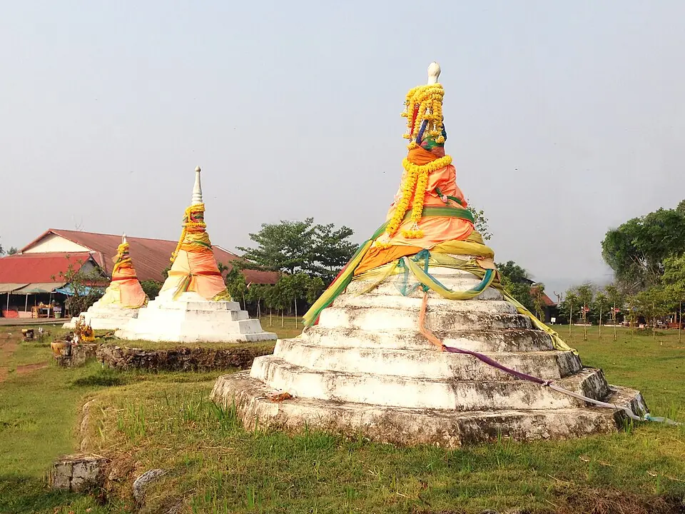
The three pagodas at Three Pagodas Pass, Sangkhla Buri district · Photo: Woonzen5558 · CC BY-SA 4.0 via Wikimedia Commons Today it is a border trade checkpoint between Thailand and Myanmar. Three small white chedis stand in a row on a lawn, surrounded by souvenir shops, about 20 kilometres from the district town of Sangkhla Buri. The crossing opens and closes as the situation changes, so check before you travel.
Places to visit nearby
- The three pagodas and the border market ↗Google Maps
- The Mon Bridge, Sangkhla Buri ↗Google MapsAbout 20 km from the pass
- Kanchanaburi travel guidesongkran.com
Where to eat nearby
- Restaurants around this stop ↗Google Maps
- 3
Sam Sop (Sam Prasop, Sangkhla Buri)
The 7th army of Prince Sagu, a son of King Bodawpaya, 11,000 men, camped at Sam Sop as the second line of support, passing supplies on from the royal army to the armies in front.
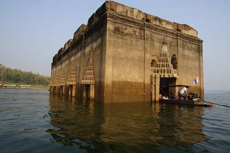
The ordination hall of the old Wat Wang Wiwekaram, known as the sunken temple, at Sam Prasop, Sangkhla Buri · Photo: Z3144228 · CC BY-SA 4.0 via Wikimedia Commons The old town of Sangkhla Buri and the former Wat Wang Wiwekaram have lain beneath the reservoir of Vajiralongkorn Dam since about 1984. When the water is low the old ordination hall rises above the surface; people call it Mueang Badan, the sunken town. You can take a boat to it from the landing near the Mon Bridge. The Mon Bridge is a long wooden bridge across the Songkalia River, and a popular place to give alms to monks in the morning.
Position on the map: The coordinates are for the Sam Prasop area, where the Songkalia, Bikhli and Ranti rivers meet. The old camp site lies beneath the surface of the reservoir.
Places to visit nearby
- The Mon Bridge (Uttamanusorn Bridge) ↗Google Maps
- Mueang Badan, the former Wat Wang Wiwekaram ↗Google MapsBy boat, when the water is low
- Wat Wang Wiwekaram and the Bodh Gaya-style chedi ↗Google Maps
- Kanchanaburi travel guidesongkran.com
Where to eat nearby
- The morning market on the Mon side ↗Google MapsMon home-style food
- Restaurants around this stop ↗Google Maps
- 4
Tha Din Daeng
The 6th army of Prince Kama, another of the king's sons, 12,000 men, camped at Tha Din Daeng as the first line of support behind the vanguard. When the vanguard was broken at Lat Ya, it was this army that passed the news up to the royal army.
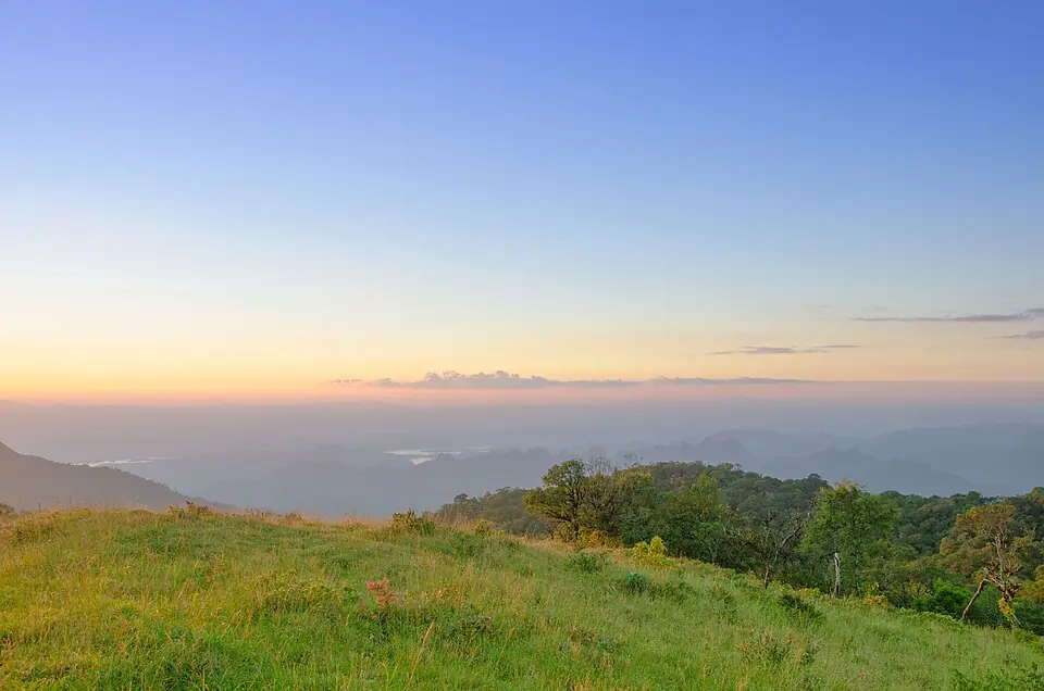
The mountains above the Vajiralongkorn Dam reservoir, in Khao Laem National Park · Photo: Kzoverheat · CC BY-SA 3.0 via Wikimedia Commons Today Ban Tha Din Daeng is a community on the shore of the Vajiralongkorn Dam reservoir, in Prang Phle subdistrict. There is no memorial of the fighting in the area. Highway 323 between Thong Pha Phum and Sangkhla Buri passes close by, with reservoir viewpoints and Khao Laem National Park along the way.
Position on the map: Approximate coordinates of the Ban Tha Din Daeng area, Prang Phle subdistrict, Sangkhla Buri district. The old camp site on the Khwae Noi River lies beneath the reservoir of Vajiralongkorn Dam.
Places to visit nearby
- Vajiralongkorn Dam (Khao Laem Dam) ↗Google Maps
- Khao Laem National Park ↗Google Maps
- Kanchanaburi travel guidesongkran.com
Where to eat nearby
- Restaurants around this stop ↗Google Maps
- 5
Sai Yok
The vanguard followed the Khwae Noi River down to Sai Yok, then cut across the hills to reach the Khwae Yai River at Tha Kradan. Every sack of the vanguard's supplies had to be carried along this stretch, where Prince Khun Nen's guerrillas later ambushed the supply columns until they could no longer get through.
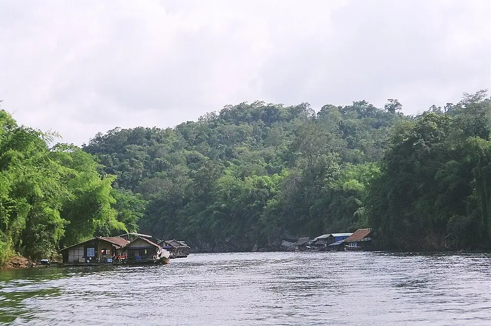
The Khwae Noi River in Sai Yok National Park · Photo: Ananda · Public domain via Wikimedia Commons Sai Yok was a frontier post of Kanchanaburi on the Khwae Noi River. Today it is Sai Yok National Park, where Sai Yok Yai Waterfall drops into the Khwae Noi, with raft houses to stay in and boat trips on the river. Sai Yok Noi Waterfall is beside Highway 323, near the district town.
Position on the map: The coordinates are for the headquarters of Sai Yok National Park on the Khwae Noi River. The old town of Sai Yok was in the same area.
Places to visit nearby
- Sai Yok Yai Waterfall, Sai Yok National Park ↗Google Maps
- Sai Yok Noi Waterfall ↗Google Maps
- Hellfire Pass Interpretive Centre ↗Google MapsThe Second World War “Death Railway”, which followed the Khwae Noi along the same line as the old military road
- Kanchanaburi travel guidesongkran.com
Where to eat nearby
- Restaurants around this stop ↗Google Maps
- 6
Kram Chang Pass (Tha Kradan)
The first place where the two sides clashed. The Mon detachment of Phraya Maha Yotha (Cheng) had been sent ahead to hold a delaying position, to block the enemy and send word to the main army at Lat Ya.
Clash with the Burmese army- Against
- The 4th army of Myin Wun, the Burmese vanguard, about 10,000–11,000 men
- Where
- Kram Chang Pass, on the Khwae Yai River above Lat Ya
- How
- A Mon detachment of 3,000 was blocking the pass. When the Burmese vanguard, many times its size, arrived, it attacked at once.
- Outcome
- The Mon detachment could not hold and fell back to the main army. The Burmese followed and built their camps at Lat Ya.
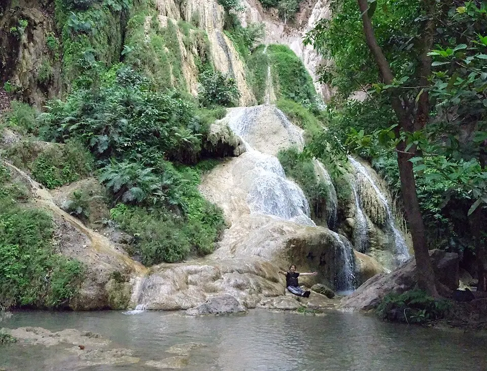
Erawan Falls in Erawan National Park, in the area of the old Kram Chang Pass · Photo: Don Ramey Logan · CC BY 4.0 via Wikimedia Commons Today this area is Erawan National Park in Si Sawat district, where the seven-tiered Erawan Falls are Kanchanaburi's main attraction. It is about 65 kilometres from the town along Highway 3199, which passes the Nine Armies' War Historical Park on the way, so the two can be seen on the same day.
Position on the map: The coordinates are for the Erawan Falls area. Present-day writers place Kram Chang Pass around Erawan National Park, on the Khwae Yai River. The exact position of the pass is not known.
Places to visit nearby
- Erawan Falls ↗Google Maps
- Srinagarind Dam ↗Google Maps
- Kanchanaburi travel guidesongkran.com
Where to eat nearby
- Restaurants around this stop ↗Google Maps
- 7
Lat Ya (Nine Armies' War Historical Park)
Prince Maha Sura Singhanat left Bangkok with 30,000 men in December 1785 and built his camps across the mouth of the valley before the Burmese came down. In January King Rama I followed with the royal army of 20,000 to help, but when the Front Palace prince reported that the Burmese were starving and close to breaking, the king went back to guard the capital.
Main battlefield of this campaign- Against
- Burma's 4th and 5th armies, about 15,000–16,000 men in all, with three more armies in support strung out behind them as far as the frontier
- Where
- Lat Ya, at the foot of the Khao Banthat hills above the old town of Kanchanaburi; today in Chong Sadao and Lat Ya subdistricts, Mueang Kanchanaburi district
- How
- They built camps across the mouth of the valley, exchanged cannon fire from battle towers, sent guerrillas to cut the supply line, tricked the enemy into thinking reinforcements arrived every day, then attacked every camp at once when the enemy was starving.
- Outcome
- The Burmese camps fell on the evening of 17 February 1786. The Siamese pursued as far as the frontier, and King Bodawpaya ordered every army back to Martaban.
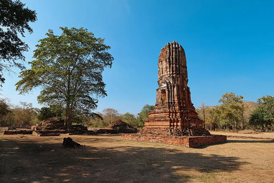
Wat Khun Phaen, a ruin in old Kanchanaburi town, Lat Ya subdistrict, a frontier town at the time of the Nine Armies' War. It is a different place from the Nine Armies' War Historical Park, which lies further along Highway 3199 · Photo: Kriengsak Jirasirirojanakorn · CC BY-SA 4.0 via Wikimedia Commons The Royal Thai Army built the Nine Armies' War Historical Park in Chong Sadao subdistrict, Mueang Kanchanaburi district. It is about 700 metres off Highway 3199 (Kanchanaburi–Srinagarind Dam), turning at around kilometre 24, roughly 40 kilometres from the town. Inside are an exhibition building, a sand-table model of the terrain and the two sides' positions, and an observation tower looking over the plain and the hills around it. Travel websites say it is open daily, 9:00 am–4:00 pm, with no entrance fee; check before you go.
Position on the map: The coordinates are for the Nine Armies' War Historical Park in Chong Sadao subdistrict, as given by travel websites. The two sides' actual lines of camps covered a wide area along the foot of the hills.
Places to visit nearby
- Nine Armies' War Historical Park ↗Google MapsExhibition, sand-table model and observation tower
- Old Kanchanaburi town (Wat Khun Phaen, Wat Pa Lelai) ↗Google MapsThe site of Kanchanaburi at the time of the Nine Armies' War, before the town moved to Pak Phraek
- Erawan Falls ↗Google MapsAbout 40 km further along Highway 3199
- Kanchanaburi travel guidesongkran.com
Where to eat nearby
- Pak Phraek Walking Street (Saturday evenings) ↗Google MapsKanchanaburi's old town quarter
- Restaurants around this stop ↗Google Maps
Travel guides for the provinces on this route
Things to do and where to eat in each province, from songkran.com, our sister travel site
- KanchanaburiStop 2, 3, 4, 5, 6, 7Kanchanaburi travel guide →
Where historians still disagree
- Numbers: the royal chronicle and Thai Rop Phama give 89,000 for the Burmese armies on this route, out of 144,000 in all, while the Burmese chronicle gives about 134,000 for the whole invasion. Figures of that time are the numbers ordered to be levied, not numbers actually counted in the field.
- The date of the assault: the chronicle gives Friday, the 4th day of the waning moon of the 3rd lunar month, which works out as 17 February 1786. Some studies convert it to 18 February.
- Prince Khun Nen's guerrillas: the royal chronicle gives their strength as 1,500 men, some writers as 1,800, and the location of Phu Takhrai, where they ambushed the supply columns, cannot yet be fixed with certainty.
- The site of the battlefield: the two sides' lines of camps ran for several kilometres along the foot of the hills. The Nine Armies' War Historical Park is a place of remembrance; it does not mean the fighting took place only there.
Frequently asked questions
Where is Lat Ya?
North of Kanchanaburi town, towards Srinagarind Dam, in Lat Ya and Chong Sadao subdistricts of Mueang Kanchanaburi district. The memorial site is the Nine Armies' War Historical Park, near Highway 3199, about 40 kilometres from the town.
Who commanded the Siamese at Lat Ya?
Prince Maha Sura Singhanat, the Front Palace prince and younger brother of King Rama I. He commanded 30,000 men, with Phraya Kalahom Ratchasena and Phraya Cha Saenyakon leading the vanguard.
Why did the Burmese lose with more men?
Because the Burmese armies had to march in a line through the valley and found its mouth blocked, only the vanguard of about 15,000 actually fought. And the supplies they had to carry so far were cut by Siamese guerrillas until the army starved.
Did King Bodawpaya reach Lat Ya?
No. The royal army was camped at the head of the Ranti River near Three Pagodas Pass. When the vanguard was broken it withdrew to Martaban.
- Nine Armies' War – Thai Wikipedia, citing the Royal Chronicle of Rattanakosin, First Reign, and Thai Rop Phama (in Thai)
- Burmese–Siamese War (1785–1786) – Wikipedia
- Prince Khun Nen, commander of the guerrilla force – Silpa Wattanatham (in Thai)
- The Nine Armies' War: how Siam used guerrillas and deception against the Burmese – Manager Online (in Thai)
- The Nine Armies' War Historical Park – lovethailand.org (in Thai)
Last updated 14 November 2026