Home › Campaign routes › The Battle of Khao Ngu, Ratchaburi: the 2nd army from Tavoy
The Battle of Khao Ngu, Ratchaburi: the 2nd army from Tavoy
Burma's 2nd army, 10,000 men, set out from Tavoy. Its task was to take Ratchaburi and Phetchaburi and cut the supply line of the Siamese army at Lat Ya. But the crossing of the Tenasserim Range made it late, and its columns did not arrive together. Its vanguard built a camp at Khao Ngu, less than ten kilometres from the town of Ratchaburi, when the great battle at Lat Ya was already over.
- Enemy army
- Siamese army
- 1Stops, numbered as in the list below
- 2Clash with the Burmese
- 2Main battlefield
- 1–3Several stops close together: tap to zoom in
- ≈ approximate position
Press + to zoom in, then drag to move the map; on a phone you can pinch. Tap a number to read about that stop.
The mark ≈ means an approximate position. Borders on the map are present-day borders, shown only to help you find places. The routes are approximate lines drawn from the chronicles and later studies, not the actual path step by step. Dashed lines are enemy armies; solid lines are Siamese armies.
Three columns, two passes
The commander, Anaukpet Taik Wun, divided his army into three columns. The vanguard of 3,000 under the governor of Tavoy came in through Chao Khwao Pass, on the side of today's Suan Phueng district. A rear column of another 3,000 stayed behind at the pass. The commander himself took 4,000 men round by Bong Ti Pass towards Sai Yok, then came down to camp at Thong Chatri, the Chom Bueng plain.
Both passes over the hills were steep and barren, so the columns did not arrive together and lost touch with the royal army. As late as the end of February 1786 this army still did not know that King Bodawpaya's royal army had already withdrawn.
Won by an army that happened to march past
Siam had left Chaophraya Thammathikon and Phraya Yommarat to hold Ratchaburi with 5,000 men. But the two did not send out patrols widely enough, and so did not know the Burmese had already camped at Khao Ngu. The ones who found the Burmese camp were instead the troops of Phraya Kalahom Ratchasena and Phraya Cha Saenyakon, whom the Front Palace prince had sent overland from Lat Ya.
This force, fresh from a great victory, attacked at once. The camp at Khao Ngu fell in a single engagement, and the Siamese pressed on to break the rear column at Chao Khwao Pass as well. On hearing the news, the Burmese commander at Thong Chatri withdrew without a fight.
The route in 5 stops
Dates on this page are in the Common Era. Thai sources date the war in the Buddhist Era, and old documents began the new year around April, so they count the events of January to March 1786 (BE 2329) as still falling in BE 2328. That is why many Thai books place the whole Nine Armies' War in BE 2328 (1785).
- 1
Tavoy (base of the 2nd army)
The 2nd army of Anaukpet Taik Wun, 10,000 men, was based at Tavoy with orders to attack Ratchaburi and Phetchaburi and then go down to join the 1st army at Chumphon. It marched in three columns, and the steep hill roads meant they did not arrive together.
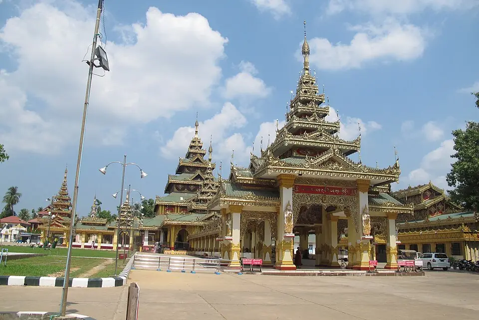
A monastery in Dawei (Tavoy), Myanmar · Photo: Bundit Sincharoen · CC BY 3.0 via Wikimedia Commons A port town on the Andaman coast in Myanmar's Tanintharyi Region, today called Dawei. It lies opposite Kanchanaburi and Ratchaburi, with the Tenasserim Range in between. Several passes lead from Tavoy into Thailand; the main ones are Bong Ti Pass towards Sai Yok and Chao Khwao Pass towards Suan Phueng.
- 2
Chao Khwao Pass (Suan Phueng)
The vanguard of 3,000 under the governor of Tavoy came in through this pass and went on to Khao Ngu, while the rear column of another 3,000 under Chik Sip Bo stayed behind at the pass.
Clash with the Burmese army- Against
- The rear column of the 2nd army, about 3,000 men under Chik Sip Bo
- Where
- Chao Khwao Pass, on the frontier towards Suan Phueng
- How
- After the victory at Khao Ngu, the troops of Phraya Kalahom Ratchasena and Phraya Cha Saenyakon chased the fleeing Burmese all the way to the pass and attacked again at once.
- Outcome
- The Burmese rear column broke in its turn, and the whole 2nd army withdrew to Tavoy.
Suan Phueng is a frontier district of Ratchaburi, up against the Tenasserim Range, with the Phachi River running through it. Today it is known for resorts and nature spots such as the Bo Khlueng hot stream and Kao Chon Waterfall.
Position on the map: The coordinates are for the district town of Suan Phueng. Present-day writers place Chao Khwao Pass in Suan Phueng district, on the road that follows the Phachi River out to the frontier.
Places to visit nearby
- Bo Khlueng hot stream ↗Google Maps
- Kao Chon Waterfall ↗Google Maps
- Ratchaburi storiessongkran.com
Where to eat nearby
- Restaurants around this stop ↗Google Maps
- 3
Thong Chatri (the Chom Bueng plain)
The commander himself, Anaukpet Taik Wun, led the centre column of 4,000 across Bong Ti Pass towards Sai Yok, a steep hill road, and camped at Thong Chatri. This column did not fight. When it learned that the vanguard had been broken and the royal army had already withdrawn, it turned back.
Chom Bueng is a plain among the hills, halfway from the frontier at Suan Phueng to the town of Ratchaburi. The main attractions are Chom Phon Cave and the Tham Chom Phon Arboretum.
Position on the map: The coordinates are for the district town of Chom Bueng. Present-day writers identify Thong Chatri with the Chom Bueng plain.
Places to visit nearby
- Chom Phon Cave ↗Google Maps
- Ratchaburi storiessongkran.com
Where to eat nearby
- Restaurants around this stop ↗Google Maps
- 4
Khao Ngu, Ratchaburi
The Burmese vanguard built its camp at the foot of Khao Ngu without the force holding Ratchaburi being aware of it, and sent men into the orchards to pick coconuts and fruit for food.
Main battlefield of this campaign- Against
- The vanguard of the 2nd army, about 3,000 men under the governor of Tavoy
- Where
- The foot of Khao Ngu, about 8 kilometres from the town of Ratchaburi
- How
- The land force of Phraya Kalahom Ratchasena and Phraya Cha Saenyakon, fresh from the victory at Lat Ya, came upon the Burmese camp on its march south and attacked at once. The fighting came to hand-to-hand combat.
- Outcome
- The Burmese camp fell. The Siamese took prisoners and weapons, then pursued as far as Chao Khwao Pass.
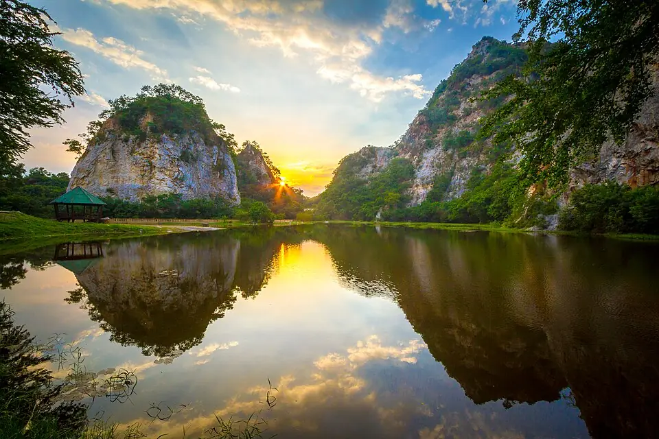
Khao Ngu Stone Park, Mueang Ratchaburi district · Photo: Manoonp · CC BY-SA 4.0 via Wikimedia Commons Today it is Khao Ngu Stone Park. Once a quarry, it was later turned into a public park, with a lake ringed by limestone cliffs, a suspension bridge, and Ruesi Khao Ngu Cave, which has a Buddha image carved on the cave wall in the Dvaravati period. It is open every day.
Places to visit nearby
- Khao Ngu Stone Park ↗Google Maps
- Ruesi Khao Ngu Cave ↗Google MapsA Buddha image carved in the Dvaravati period
- Ratchaburi National Museum ↗Google Maps
- Ratchaburi storiessongkran.com
Where to eat nearby
- Khoi Ki Market, the walking street on the Mae Klong River ↗Google MapsOpen on Friday to Sunday evenings
- Restaurants around this stop ↗Google Maps
- 5
Ratchaburi town
Chaophraya Thammathikon and Phraya Yommarat held Ratchaburi with 5,000 men, but let the Burmese camp as close as Khao Ngu without knowing it. After the fighting they were removed from their posts and paraded in disgrace around the camp. The Front Palace prince came here by boat from Kanchanaburi, then returned to Bangkok to prepare the expedition to the south.
Ratchaburi, on the Mae Klong River, was the frontier town guarding the west of Bangkok and lay on the water route for carrying supplies up to Kanchanaburi. The old town has Ratchaburi National Museum and a riverside market.
Places to visit nearby
- Ratchaburi National Museum ↗Google Maps
- Wat Mahathat Worawihan, Ratchaburi ↗Google Maps
- Ratchaburi storiessongkran.com
Where to eat nearby
Travel guides for the provinces on this route
Things to do and where to eat in each province, from songkran.com, our sister travel site
- RatchaburiStop 2, 3, 4, 5Ratchaburi stories →
Where historians still disagree
- The sites of Chao Khwao Pass and Thong Chatri: both names come from the chronicle. Present-day writers place them in Suan Phueng district and on the Chom Bueng plain respectively, but there is no firm evidence for their exact positions, so the pins on the map are approximate.
- The punishment of the commanders who held the town: the Front Palace prince asked for them to be executed. King Rama I spared their lives, and both later returned to royal service in lower posts.
Frequently asked questions
Where is Khao Ngu?
In Mueang Ratchaburi district, about 8 kilometres north-west of the town. Today it is Khao Ngu Stone Park.
Which way did Burma's 2nd army come?
From Tavoy, across the Tenasserim Range by two routes: Chao Khwao Pass towards Suan Phueng, and Bong Ti Pass towards Sai Yok.
Who stormed the Burmese camp at Khao Ngu?
Phraya Kalahom Ratchasena and Phraya Cha Saenyakon, the vanguard commanders of Prince Maha Sura Singhanat, who had marched down from Lat Ya.
Last updated 14 November 2026