Home › Campaign routes › The southern campaign: Chumphon, Chaiya and Nakhon Si Thammarat
The southern campaign: Chumphon, Chaiya and Nakhon Si Thammarat
While all of Bangkok's forces were tied down at Kanchanaburi and in the north, Burma's 1st army from Mergui crossed the Kra Isthmus and took the southern towns on the Gulf of Thailand coast one by one, from Chumphon to Chaiya and Nakhon Si Thammarat, with almost no one to resist it. Only in March 1786 did the Front Palace prince bring a fleet south to strike back.
- Enemy army
- Siamese army
- 1Stops, numbered as in the list below
- 2Main battlefield
- 4Key point, no fighting
- 1–3Several stops close together: tap to zoom in
- ≈ approximate position
Press + to zoom in, then drag to move the map; on a phone you can pinch. Tap a number to read about that stop.
The mark ≈ means an approximate position. Borders on the map are present-day borders, shown only to help you find places. The routes are approximate lines drawn from the chronicles and later studies, not the actual path step by step. Dashed lines are enemy armies; solid lines are Siamese armies.
Towns that had to fight alone
Before the war Bangkok sent letters warning the southern towns that the Burmese were coming, but it sent no army to help them, because the enemy on the Kanchanaburi front was closer to the capital and many times more numerous. The governors of Chumphon and Chaiya did not have the men to fight an army of 7,000, so they led their people into the forest, saving the people first and leaving the towns to be burned.
At Nakhon Si Thammarat the Burmese did not have to fight at all. They simply had prisoners call out that Bangkok had fallen. Chaophraya Nakhon, the governor, who had long been waiting for the royal army, believed it and abandoned the town. The only town that prepared to fight was Phatthalung, where a monk named Phra Maha Chuai roused the townspeople.
The Front Palace prince's fleet strikes back
After the victories at Lat Ya and Ratchaburi, the Front Palace prince returned to Bangkok and then took a fleet of about 20,000 men south in March 1786. He landed at Chumphon and sent his vanguard on to Chaiya. The Burmese army, which was about to march on Phatthalung, had to turn back north to meet it, and was surrounded and broken at Chaiya.
From Chaiya the prince went on to Nakhon Si Thammarat. He had the governors gather the people who had fled into the forest and resettle their towns, and made Phra Maha Chuai Phraya Thukkharat. He then went down as far as Songkhla and dealt with the Malay towns. The force sent against Pattani on this occasion brought the great Phaya Tani cannon back to Bangkok.
The route in 7 stops
Dates on this page are in the Common Era. Thai sources date the war in the Buddhist Era, and old documents began the new year around April, so they count the events of January to March 1786 (BE 2329) as still falling in BE 2328. That is why many Thai books place the whole Nine Armies' War in BE 2328 (1785).
- 1
Mergui (base of the 1st army)
The 1st army, 10,000 men, was based at Mergui from mid-1785 and was the first to move. Its first commander was executed for failing to gather enough supplies for the royal army, and Kinwun Mingyi took over. He divided it into a fleet of about 3,000 to attack Thalang and a land force of about 7,000 to cross to the Gulf of Thailand coast.
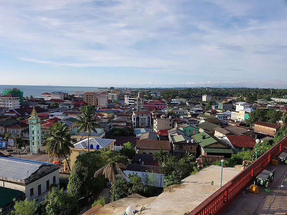
Myeik (Mergui), a port on Myanmar's Andaman coast · Photo: Kyaw_Zin_Win(KT) · CC BY-SA 4.0 via Wikimedia Commons A port town on the Andaman coast in the far south of Myanmar, today called Myeik. In the Ayutthaya period it was a Siamese port; it was lost to Burma in 1765. In the Nine Armies' War the 1st army was based here from mid-1785 to stockpile supplies, then split into a land force and a fleet to attack Siam's southern towns.
- 2
Kra Buri and the Pak Chan River
The land force passed through Ranong and Kra Buri and crossed the hills at Pak Chan, the narrowest part of the Malay Peninsula, coming out at Chumphon.
Kra Buri district, Ranong province, lies on the Kra Buri River, also called the Pak Chan, which forms the border between Thailand and Myanmar. This is the narrowest part of the Malay Peninsula, known as the Kra Isthmus: from the Andaman side it is a short way over the hills to Chumphon.
Places to visit nearby
- The Kra Isthmus viewpoint (Kio Kho Khot Kra) ↗Google Maps
- Ranong storiessongkran.com
Where to eat nearby
- Restaurants around this stop ↗Google Maps
- 3
Chumphon town
The governor of Chumphon did not have the men to fight, so he led the townspeople into the forest, and the Burmese burned the town. Three months later the Front Palace prince's fleet landed here and made Chumphon the headquarters of the counter-attack.
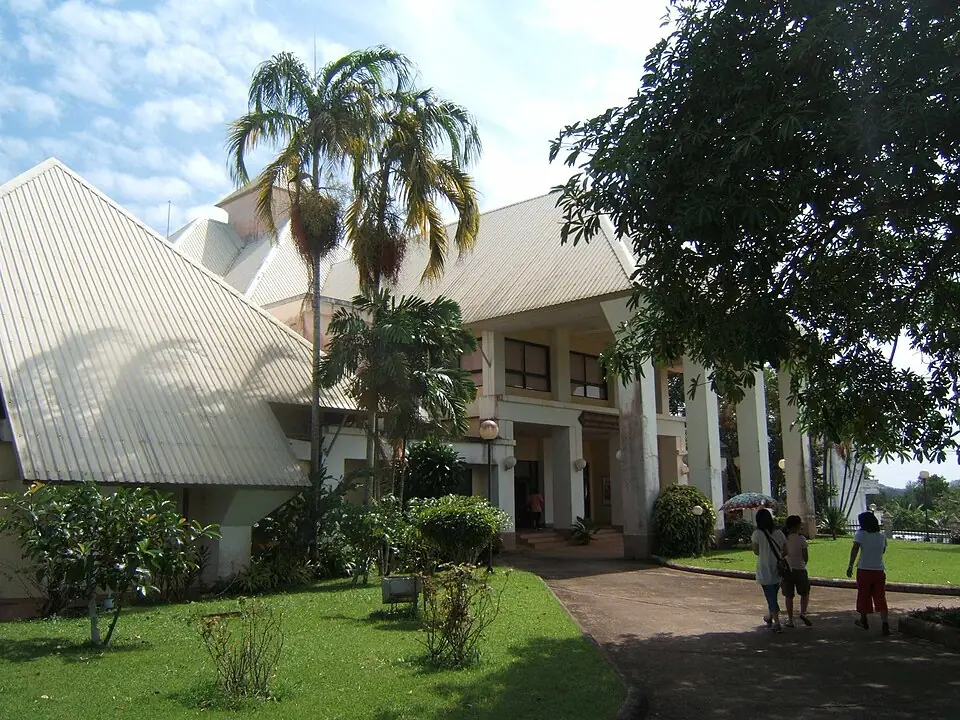
Chumphon National Museum · Photo: Media lib · CC BY-SA 3.0 via Wikimedia Commons Chumphon is the gateway to the south on the Gulf of Thailand side. The story of the town, from prehistory to the wars of various periods, is told at Chumphon National Museum. On the coast are Sai Ri Beach and the shrine of Prince Chumphon (Krom Luang Chumphon Khet Udomsak).
Places to visit nearby
- Chumphon National Museum ↗Google Maps
- Sai Ri Beach and the Prince Chumphon shrine ↗Google Maps
- Chumphon storiessongkran.com
Where to eat nearby
- Restaurants around this stop ↗Google Maps
- 4
Chaiya town
On the way south the Burmese burned Chaiya as they had burned Chumphon. On the way back it became the only battlefield of the southern campaign on the Gulf of Thailand coast.
Main battlefield of this campaign- Against
- The vanguard of the 1st army under Nemyo Gonnarat, about 2,500 men
- Where
- The town of Chaiya
- How
- The Front Palace prince's vanguard under Phraya Kalahom Ratchasena and Phraya Cha Saenyakon arrived first and surrounded the Burmese before their camp was finished. Heavy rain put the Siamese cannon out of action, and the Burmese broke out of the encirclement to the west.
- Outcome
- The Burmese officer Tong Phayung Bo was killed in the fighting. The Siamese pursued and took many prisoners, and the whole Burmese army withdrew over the hills towards Mergui.
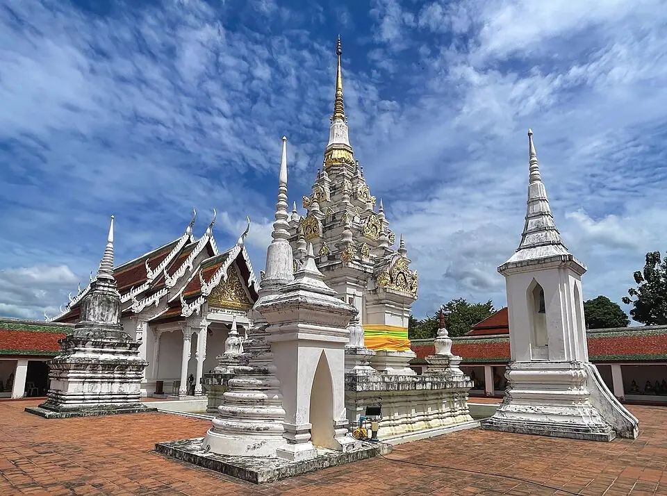
Phra Borommathat Chaiya, at Wat Phra Borommathat Chaiya Ratchaworawihan · Photo: samfotograf · CC BY-SA 4.0 via Wikimedia Commons Chaiya today is a district of Surat Thani. It has Wat Phra Borommathat Chaiya, whose chedi is the most complete example of Srivijaya art in the country, with Chaiya National Museum next to the temple. Not far away is Suan Mokkh, the forest monastery of Buddhadasa Bhikkhu. The town's best-known souvenir is Chaiya salted eggs.
Places to visit nearby
- Wat Phra Borommathat Chaiya ↗Google Maps
- Chaiya National Museum ↗Google Maps
- Suan Mokkh (Suan Mokkhaphalaram) ↗Google Maps
- Things to do in Surat Thanisongkran.com
Where to eat nearby
- Chaiya salted eggs, at the souvenir shops around Chaiya market ↗Google Maps
- Where to eat in Surat Thanisongkran.com
- Restaurants around this stop ↗Google Maps
- 5
Tha Kham (Tapi River, Phunphin)
Chaophraya Nakhon Si Thammarat (Phat) sent about 1,000 men to hold the crossing of the Maenam Luang, the only way a land force could reach Nakhon Si Thammarat.
Key point on this route- Against
- Burma's 1st army, about 7,000 men
- Where
- The crossing of the Tapi River, today in Phunphin district
- How
- The Burmese used a false report instead of a battle. They had prisoners from Chaiya shout across the river that Bangkok had fallen to the Burmese, and that the defenders should hurry to tell their master to come and submit.
- Outcome
- The force guarding the crossing carried the message back to the governor, and the road down to Nakhon Si Thammarat lay open.
Tha Kham is the crossing of the Tapi River, once called the Maenam Luang, on the overland road from Chaiya down to Nakhon Si Thammarat. Today it is in Phunphin district, the site of Surat Thani railway station and of Chulachomklao Bridge, the steel railway bridge over the Tapi.
Places to visit nearby
- Chulachomklao Bridge ↗Google Maps
- Things to do in Surat Thanisongkran.com
Where to eat nearby
- Where to eat in Surat Thanisongkran.com
- Restaurants around this stop ↗Google Maps
- 6
Nakhon Si Thammarat town
Chaophraya Nakhon (Phat) believed the report that Bangkok had fallen, because he had waited so long and no royal army had come to help. He took his family and fled into the hills to the west, and the townspeople scattered after him. The Burmese occupied the town and went out hunting for people. When the Front Palace prince arrived after the victory at Chaiya, he judged that the enemy had been too strong for the governor to fight, so he only put him on probation and had him gather the people and re-establish the town.
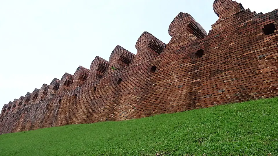
The city wall of Nakhon Si Thammarat, north side · Photo: Suwannee.payne · CC BY-SA 3.0 via Wikimedia Commons Nakhon Si Thammarat is the largest town of the south. A stretch of its brick town wall and moat can still be seen on the north side. At the centre of town is Wat Phra Mahathat Woramahawihan, and every Saturday the Lat Na Phra That market is held in front of it.
Places to visit nearby
- The town wall of Nakhon Si Thammarat ↗Google Maps
- Wat Phra Mahathat Woramahawihan ↗Google Maps
- Nakhon Si Thammarat National Museum ↗Google Maps
- Things to do in Nakhon Si Thammaratsongkran.com
Where to eat nearby
- Lat Na Phra That market (Saturdays) ↗Google Maps
- Where to eat in Nakhon Si Thammaratsongkran.com
- Restaurants around this stop ↗Google Maps
- 7
Khlong Tha Samet (Phra Maha Chuai's camp)
A little over a thousand people of Phatthalung, led by Phra Maha Chuai, came up and built a camp across the road the Burmese would take to attack Phatthalung and Songkhla. It was the only town on the Gulf coast of the south that stood to fight.
Key point on this route- Against
- Burma's 1st army, which was preparing to march down from Nakhon Si Thammarat
- Where
- The Khlong Tha Samet area, today in Cha-uat district, Nakhon Si Thammarat province
- How
- They built a camp across the road in advance, with Phra Maha Chuai's takrut amulets and protective cloths to give them courage.
- Outcome
- It never came to a battle. The Burmese had to turn back north to meet the army from Bangkok at Chaiya. After the war Phra Maha Chuai became Phraya Thukkharat.
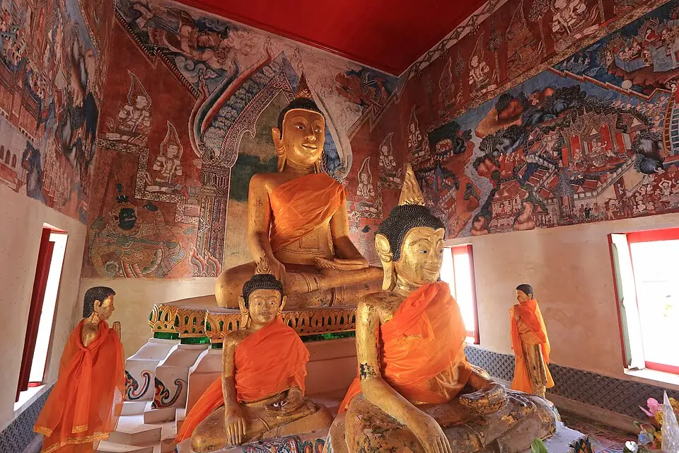
Inside the ordination hall of Wat Wang, Lam Pam subdistrict, old Phatthalung · Photo: KOSIN SUKHUM · CC BY-SA 4.0 via Wikimedia Commons Phatthalung in those days stood in Lam Pam subdistrict, on the shore of Songkhla Lake. Wat Wang, the town's principal temple, and the Governor's Palace of Phatthalung can still be visited there. In today's Phatthalung town a monument to Phraya Thukkharat (Chuai) stands at the Tha Miram junction; Princess Maha Chakri Sirindhorn laid its foundation stone on 16 August 1993.
Position on the map: Approximate coordinates of the Cha-uat district area, Nakhon Si Thammarat province. Present-day writers place the camp at Khlong Tha Samet in Tha Samet subdistrict. The exact position of the camp is not known.
Places to visit nearby
- Monument to Phraya Thukkharat (Chuai) ↗Google MapsTha Miram junction, Phatthalung town
- Wat Wang, Lam Pam ↗Google MapsThe principal temple of old Phatthalung, with mural paintings
- The Governor's Palace of Phatthalung ↗Google Maps
- Things to do in Nakhon Si Thammaratsongkran.com
Where to eat nearby
- Where to eat in Nakhon Si Thammaratsongkran.com
- Restaurants around this stop ↗Google Maps
Travel guides for the provinces on this route
Things to do and where to eat in each province, from songkran.com, our sister travel site
- RanongStop 2Ranong stories →
- ChumphonStop 3Chumphon stories →
- Surat ThaniStop 4, 5Things to do in Surat Thani →Where to eat in Surat Thani →
- Nakhon Si ThammaratStop 6, 7Things to do in Nakhon Si Thammarat →Where to eat in Nakhon Si Thammarat →
Where historians still disagree
- The number of Burmese on the Gulf coast: the 1st army had 10,000 men, and once the fleet of 3,000 that went to Thalang is subtracted, 7,000 should remain. But the figures the different versions give for the vanguard and the main body do not add up to the same total.
- Did the Burmese reach Khlong Tha Samet? Some versions say the two sides faced each other from their camps and the Burmese then withdrew of their own accord, while Thai Rop Phama says the Burmese had not yet marched down from Nakhon Si Thammarat.
- The Phaya Tani cannon: the taking of the cannon from Pattani was a sequel to the Nine Armies' War. The details of how it was moved come from legend and from the chronicle of Pattani.
Frequently asked questions
Which towns did the Burmese take in the south?
On the Gulf of Thailand coast: Chumphon, Chaiya and Nakhon Si Thammarat. On the Andaman coast: Takua Pa, Takua Thung and Pak Phra. But they could not take Thalang.
Who was Phra Maha Chuai?
A monk, the abbot of Wat Pa Lilai in Phatthalung, who persuaded about a thousand townspeople to go out and build a camp against the Burmese. After the war he left the monkhood and became Phraya Thukkharat.
Where did the southern campaign end?
At Chaiya, when the Front Palace prince's vanguard broke the Burmese army in March 1786. The remaining Burmese withdrew over the hills to Mergui.
Last updated 14 November 2026